

I Took the Wrong Route Up Mt. Massive: Lessons From the Southwest Slopes
I Took the Wrong Route Up Mt. Massive: Lessons From the Southwest Slopes
Eight miles sounded like a good way to ease back into Colorado 14er season. Then Mount Massive reminded me that fewer miles do not necessarily mean an easier hike.
I chose the alternate Southwest Slopes route up Colorado’s second-highest peak because I wanted a shorter day than the standard route. I knew it would be steeper. What I underestimated was how much that climbing would wear me out, especially after I lost the trail in the rocks and wasted energy going the wrong way.
I made the summit, and the views were incredible. But this was a much tougher first hike of the season than I had bargained for.
Why I Chose Mount Massive’s Southwest Slopes Route
My goal is to summit all 58 Colorado 14ers. Going into this hike, I had completed 15. The previous year, I only managed two, Mount Antero and Mount Princeton, which was disappointing. This season, I was hoping to get closer to 10 if my schedule cooperated.
Mount Massive was my first one of the season, so I was still working my way back into 14er shape. When I compared the routes, I focused more on mileage than on how the climbing was distributed.
| Route | Round-trip distance | Access and effort |
|---|---|---|
| Standard route | 13.75 miles | Trailhead lower on the road, accessible to just about any vehicle |
| Southwest Slopes | 8 miles | About 4,000 feet of elevation gain, with a rough approach road requiring a high-clearance 4x4 |
On paper, cutting almost six miles off the round trip was appealing. I had read that the alternate route was steeper, but I figured the shorter distance would be a better warm-up.
That was the tradeoff I kept reconsidering as I climbed: would I rather walk more miles, or get hit with steep climbing much sooner? Halfway up, I still did not have a confident answer.
The Southwest Slopes route saves distance, not effort. And the drive matters, too. The road has rough sections and obstacles, so this is not the same easy-access trailhead situation as the standard route. For route research alongside this personal account, 14ers.com’s Mount Massive page is a useful reference.
Camping Along Half Moon Road
I camped nearby so I could get an early start from the Half Moon Lakes trailhead. There are two formal campgrounds along the road, plus plenty of dispersed campsites.
There are also plenty of people. With both Mount Massive and Mount Elbert drawing hikers to the area, finding a formal campsite can be difficult, especially on weekends.
When I climbed Mount Elbert, I arrived on a Thursday after work, around 4 p.m., and got a spot. By about 6 p.m., people were already driving around looking for somewhere to stay. That experience gave me a pretty good idea of how quickly things can fill up.
Finding a Little More Space in Half Moon Gulch
Near the North Half Moon trailhead, the road crosses Half Moon Creek. Depending on your vehicle’s capability and clearance, crossing it can open up more dispersed camping options in Half Moon Gulch. I prefer a little space, so that was appealing to me.
On my trip, there were roughly four or five dispersed sites across the creek before the road got steep. My campsite was the last one before that climb. It was relatively flat, tucked just off the route, and big enough for a few vehicles and tents.
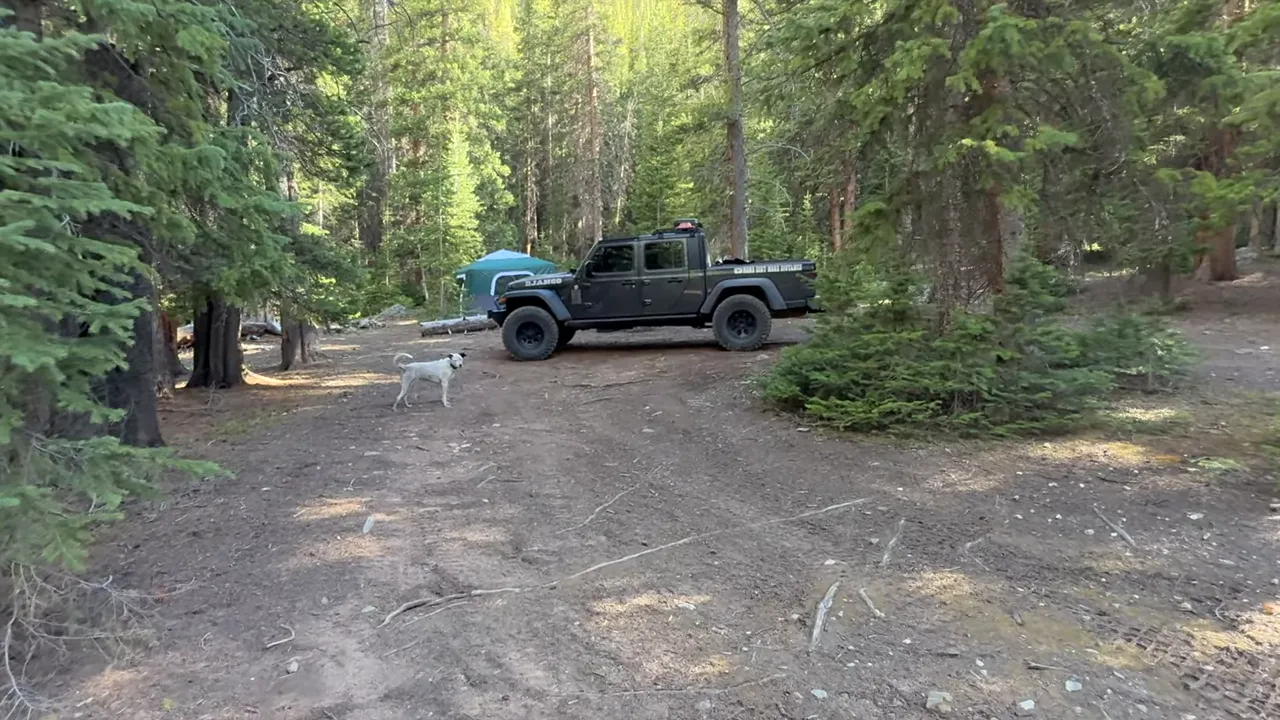
Farther up, at the top of the gulch, there were several more dispersed sites in an incredible setting. If crossing the creek is not an option, there are still lots of sites along the main road. The tradeoff is having more company.
Those were the options I found on this trip, not a guarantee of availability or crossing conditions for another visit.
The First Mile: Forest, a Fallen Tree, and Early Views
The hike started in the trees on a beautiful morning. For most of the first mile, the forest kept the bigger mountain views hidden.
One obstacle was impossible to miss: a massive fallen tree blocking the trail. The trunk and branches sprawled across the path, so I had to look for a way around rather than push straight through.

I found a manageable opening around it and connected back to the trail. It was a small detour, nothing too bad, but a reminder that even the wooded approach can require a little attention.
A little under a mile in, I reached an opening with views into the surrounding mountains and Half Moon Creek in the distance. Those moments are a big part of why I love getting out here. You step out from the trees, the landscape opens up, and suddenly the early start feels completely worth it.
After the first section of significant climbing, I came into a more open area with great mountain views and a welcome chance to catch my breath. Enjoy that gentler section. The mountain has plenty more climbing waiting above it.
The Boulder Field and My Wrong Turn
The long climb through the boulder field was hard. I am not going to pretend otherwise. For the most part, the route was not especially difficult to follow, but I still managed to lose it.
Here is where I went wrong: as the trail became less obvious among the scree and rocks, I kept following anything that looked vaguely like a path. Then I spotted a little edge above me and decided that must be where I needed to go.
So I struggled up toward it. When I finally reached that edge and looked down, there was the actual trail below me.
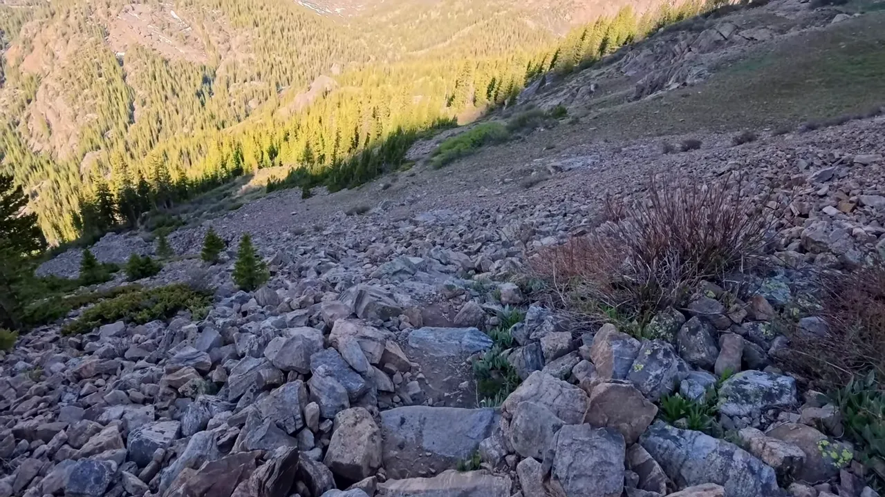
I felt pretty foolish. I had spent a whole lot of energy climbing awkward terrain for no reason, on a route that was already taking plenty out of me.
My mistake was treating a plausible-looking line as proof that I was still on the trail. In that rocky terrain, I needed to stop and identify the route instead of continuing toward whatever looked promising uphill.
That was the real wrong turn. Choosing the Southwest Slopes route was a deliberate tradeoff. Losing the trail and adding unnecessary work was not.
Once the gentler open section was behind me, the hike became one climb after another. The shorter mileage was no longer feeling like much of a bargain.
Taking a Break and Looking Back
Eventually, I needed a proper pause. My legs were feeling the climb, and looking uphill made it seem as though I was never going to get there.
That is when I like to turn around and look down.
Far below, I could see where I had cleared the trees. From that perspective, the progress was obvious. I might still have a lot of mountain above me, but I had already climbed a long way.
It did not make the next section easier on my legs. It did help my head. Sometimes a break is not just about catching your breath. It is about reminding yourself that you are moving forward, even when the top seems stubbornly far away.
The Ridge, the False Summit, and Finally the Top
By the time I reached the point where the southwest route met the eastern route, my legs were gassed. I was close, but the rocky terrain ahead looked intimidating.
Fortunately, it looked tougher than it felt once I started moving through it. The hike along the ridgeline was not too bad compared with the climbing I had already done.
The harder part was realizing that the high point I was approaching was not the summit.
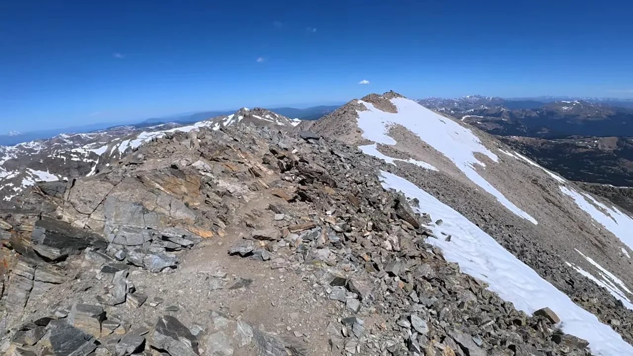
After reaching the false summit, I could see the actual summit farther along the ridge. That is a tough discovery when you have already convinced yourself you are almost done.
But I kept going, and eventually I made it to the top of Mount Massive.
The views were incredible. The hike had been a lot harder than I expected, but standing up there was a pretty good payoff for all that work. My only complaint was that I still had to hike all the way back down.
The lesson I took home was simple: do not choose a 14er route on mileage alone. Eight miles with 4,000 feet of elevation gain is still a serious day, especially when you are getting back into shape. Add a wrong turn in the rocks and a false summit near the finish, and that shorter route can feel plenty long.
I got the summit. I also got a much more demanding season opener than I had planned.