

Mt. Shavano & Tabeguache Peak: The “Easy Part” Wasn’t So Easy
Mt. Shavano & Tabeguache Peak: The “Easy Part” Wasn’t So Easy
Getting to the top of Mount Shavano felt like a solid accomplishment. My legs had worked through a long climb, endless switchbacks, and a rocky summit approach. After a snack and about ten minutes of rest, I still had another Colorado 14er to climb.
Tabeguache Peak was supposed to be the easy part. For me, it turned into a slower, steeper, more confusing finish than I expected.
The trip had plenty going for it: a great dispersed campsite near the trailhead, a beautiful morning through the aspens, and weather that held while I worked my way toward both summits. But if you’re planning to pair Mount Shavano and Tabeguache Peak, don’t treat that second mountain like a freebie.
Key Takeaways
- Dispersed camping near the trailhead made an early start easier than camping farther down the approach road.
- The combined hike required planning for roughly 12 miles and 5,600 feet of elevation gain.
- Faint trails and route-finding between the summits made Tabeguache slower than I expected.
- Reaching Shavano still left another steep climb that demanded time and energy.
Getting to the Mount Shavano Trailhead
I drove in on County Road 250, then continued onto County Road 252 toward the Mount Shavano trailhead. County Road 250 is where the approach turns to dirt.
Once you enter BLM land, there are several designated campsites. Those first sites are still about six miles from the trailhead, though. They could work if you don’t mind driving farther in the morning, but my goal was to camp close enough to make an early start simple.
The road up was bumpy and rocky, with some rutted sections. It wasn’t anything crazy, but a little clearance would definitely make the drive more comfortable.
I saw a late-model Toyota Camry coming down, so this wasn’t a road that only heavily modified vehicles could handle under the conditions I encountered. Still, I wouldn’t have wanted to bring something really low-profile up there. Seeing one sedan make it through isn’t a guarantee that every car will be comfortable on the same road.
My impression was straightforward: take it slowly, pay attention to the rocks and ruts, and don’t assume the dirt-road approach will be as quick as the mileage suggests.
Dispersed Camping Near the Trailhead
I didn’t find a ton of dispersed camping directly along County Road 252. The better option appeared once I reached the trailhead.
There was a sign directing traffic toward overflow parking and dispersed camping. Following that road took me past a couple of sites immediately near the trailhead, then into a much larger open area.
That clearing had campsites along the tree line, with forest roads branching off in a couple of directions where there were additional dispersed camping options. When I arrived, there was only one other vehicle way over on the opposite side.
It was quiet and spacious, although I suspected the open field might also serve as overflow parking. On a busy weekend, your peaceful campsite could feel a little more like a parking lot by morning.
A Spacious Site for the Night
I found a spot right at the entrance to the main camping area. It had room for several vehicles and multiple places to pitch tents. Just within that one area, I estimated you could fit five or six tents and still have plenty of vehicle space.
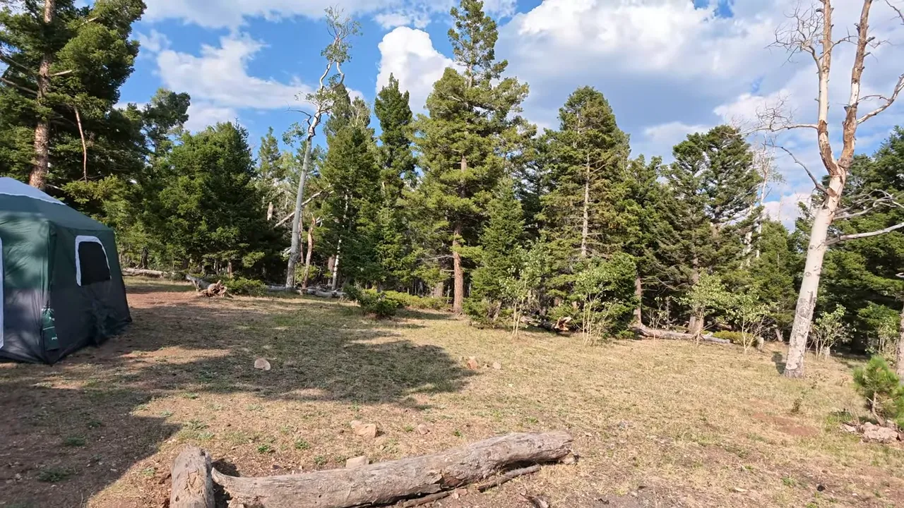
Fires weren’t allowed during my visit. There were existing fire rings around, but that didn’t change the restriction. Before a trip, check current notices and restrictions through the U.S. Forest Service, along with signs posted at the site.
From camp, I could see a mountain that I believed was Shavano. I wasn’t completely certain, but the view was good enough that I had no complaints. With the tent set up and the evening weather looking perfect, there wasn’t much left to do except relax and get ready for the morning.
A 5:45 a.m. Start for Two Colorado 14ers
At 5:45 on Monday morning, I was at the trailhead getting ready to hike Mount Shavano and Tabeguache Peak.
There was a decent amount of parking at the main trailhead, plus the overflow area a little farther down the road. Parking wasn’t an issue that morning. I’d expect a very different scene on a busy Friday or Saturday, but that was a guess, not something I experienced on this trip.
There was also a vault toilet. I’ve been giving trailhead toilets their own very unofficial ratings, and this one earned about three out of five toilets. It had what you needed, and nothing inside was too horrible. Not luxury, but perfectly workable.
The numbers I was planning around made this my longest hike of the season so far:
- Distance: roughly 12 miles round trip.
- Elevation gain: roughly 5,600 feet.
- Summits: Mount Shavano, followed by Tabeguache Peak.
- Start: 5:45 a.m., with sunrise beginning during the lower approach.
Those were approximate planning figures, not a precise record of my finished track. Either way, this was going to be a full day rather than a quick summit outing.
From the Colorado Trail Through the Aspens
The hike initially followed a section of the Colorado Trail. Eventually, I reached the junction where the Mount Shavano route branches away.
Facing the junction as I approached it, continuing to the right kept me on the Colorado Trail. The uphill branch was the way toward Shavano.
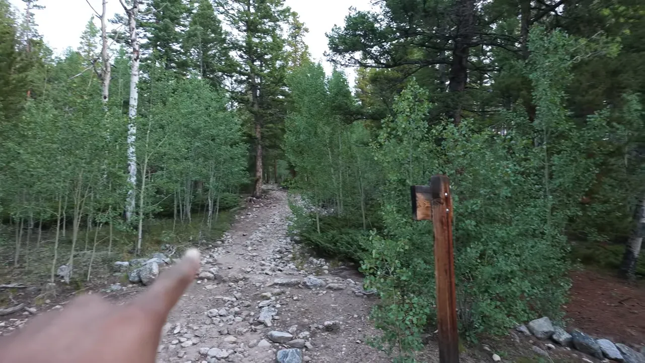
The lower trail was beautiful. There were aspens everywhere, and the rising sun started lighting up the forest as I climbed. I did find myself wishing for a nice creek alongside the trail. Nothing wrong with a creek. Still, I wasn’t going to complain about a morning like that.
A clearing offered an early look out across the surrounding landscape. Those breaks in the trees were a good reminder to stop looking only at the dirt in front of my feet.
Much of the climb felt relatively gradual at first. Then I reached a section that was noticeably steeper than anything below it, and the uphill work stopped feeling so casual.
A Potential Backpacking Spot Along the Way
Along the forested portion of the route, I noticed a cleared spot that looked suitable for a backpacking tent. There was an existing fire ring nearby, although fires were restricted during my visit.
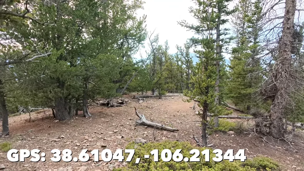
It looked like a useful spot to note for a future backpacking trip. An existing clearing or fire ring isn’t permission by itself, so current camping rules and fire restrictions still need to be checked.
The History Behind the Names
While preparing for the hike, I learned that Mount Shavano was named for Chief Shavano, a nineteenth-century leader of the Tabeguache band of the Ute people. The two mountain names share that connection.
Chief Shavano was associated with peace treaties during that period. Those agreements did not prevent the eventual displacement of Ute people from their homelands and removal to reservations. It was a sobering piece of history to carry into a day that otherwise revolved around scenery and summit goals.
Above Tree Line: Shavano Still Had Plenty Left
Getting above tree line didn’t mean I was almost done. There was still a lot of mountain ahead.
The forest gave way to open slopes, rocks, and long stretches of uphill trail. Switchback followed switchback, and eventually it felt like I had been climbing forever. My legs were definitely keeping count, even if I wasn’t.
This trip was part of my goal to climb all 58 Colorado 14ers. I had completed 18 before heading up Shavano, so these two summits would bring me to 19 and 20.
I also hoped to get Belford and Oxford done later in the season. Reaching 22 by the end of the year would make me happy. It’s a long-term project, though. I’ve met people out on these mountains in their sixties and seventies, which is a good reminder that I don’t need to finish the whole list immediately.
The Rocky Summit Approach
Near Shavano’s summit, I reached a pile of boulders that looked like it would require a short scramble. I put the camera away so I could use my hands.
As it turned out, that particular scramble wasn’t necessary. There was a small side trail around it that I hadn’t initially noticed.
That was the first place where I found the route less obvious than I wanted. I wished there were more cairns, the small rock piles used as route markers. The useful lesson wasn’t simply to charge uphill. It was to slow down and look for the actual trail before choosing a harder line through the rocks.
Eventually, I reached the top of Mount Shavano. Summit number 19 was done, and the surrounding mountains made a pretty good reward for all those switchbacks.
But I wasn’t finished. I had a snack, rested for about ten minutes, and started figuring out the way toward Tabeguache Peak.
Why Tabeguache Peak Wasn’t the Easy Part
The basic shape of the next section looked simple: follow the ridge down toward the saddle, then climb the other side to Tabeguache.
Actually finding a comfortable line through the rocks was another matter.
Leaving Shavano, I had trouble picking out the route. There were fewer obvious markers than I wanted, and I spent time wandering around, trying to decide whether I was on the trail.
A woman passed me and headed toward the saddle without any hesitation. Meanwhile, I was still studying the terrain and wondering whether I was overthinking it. She made the section look straightforward. I was not having quite the same experience.
Faint Trail, Extra Wandering
I eventually worked my way through the ridge section, but it felt more like a choose-your-own-adventure route than I had intended.
Once I could make out a faint trail, my impression was that staying higher and nearer the ridge would have been a better line than the one I had taken. That was my on-the-ground interpretation, not a precise set of route directions.
The important point is that I lost time here. Don’t build a schedule around the assumption that the connection between the summits will be obvious or quick. For advance route research, 14ers.com is a useful place to review route descriptions, maps, and recent condition reports rather than relying on another hiker’s improvised line.
Another Steep Climb on Tired Legs
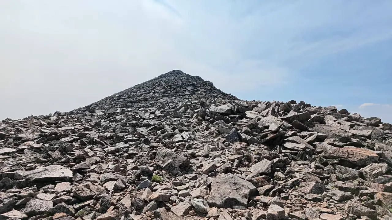
After descending toward the saddle, I still had to climb Tabeguache. From below, the slope looked steep, and I wondered whether parts of it would be mostly dirt.
The route felt less maintained and less traveled than the climb to Shavano. There were faint tracks heading in different directions, rocky terrain, and not enough clear cairns for my liking.
By then, I was tired enough that every bit of uncertainty felt more expensive. It wasn’t just another uphill stretch. It was another uphill stretch after a long climb, a summit stop, and time spent sorting out the ridge.
Thankfully, I wasn’t seeing weather moving in. That gave me room to keep working through it, but I still didn’t want the day getting too late. Clear weather didn’t make the remaining hike disappear.
Finally, I could see the summit. After all that effort, having the actual top in sight was a relief.
Summit Number 20, Then Time to Head Back
I made it to the top of Tabeguache Peak, bringing my total to 20 of 58.
I was glad I had pushed through, but I couldn’t stay long. The second summit had taken more time than I expected, and I wanted to start heading back down.
From the top, I could see Mount Antero across the surrounding terrain. There’s an off-road route in that area leading down into the gulch toward Brown’s Lake, a beautiful place I covered in my Mount Antero and Brown’s Lake trip.
Two more mountains were checked off, and I had found a great camping option for the trailhead. That made the trip a success in my book.
Still, the biggest lesson was the one Tabeguache delivered: a second summit is not automatically the easy part just because the first mountain involved most of the initial climb. Faint trails, route-finding, another steep ascent, and tired legs all added up.
I’d go into this pairing prepared for a full day, with enough time and energy left after Shavano to give Tabeguache the attention it deserves. The first summit is a milestone, not the finish line.